

Abode of Snow by Richard Doucette
/The translation for Himalaya is "Abode of Snow." It always sounded like a place I would want to go. A few years ago I went there and loved it…but I got sick and could barely walk up hill. Someday I wanted to go back and have a more successful trip. I was invited to join a group in the fall of 2017. After a long flight, we spent a couple of days in Kathmandu, getting to know the group members (15 from England, 3 from the US) and our trekking guides. It’s a short flight from Kathmandu to Lukla (2845m/9334ft), a small, bustling mountain town where all groups in the Everest region begin their trip. Look up “Most dangerous airports” and you will see why Lukla always makes the top of the list. The 1730ft runway slopes at a crazy angle, and ends at the top of a huge cliff.

Our ultimate objective was Island Peak (6189m/20,305ft), and we would also climb a few smaller peaks and passes. We took several days to trek through the villages of Lukla-Phakding-Namche-Dole-Machermo-Gokyo (4750m). We had two rest days mixed in along the way. Every day was uphill, and it got colder and colder as we went, but the pace was not bad. You just try to keep eating/drinking and hope that somehow you stay healthy. It can take several days (or never) for your body to adjust to the lack of oxygen. You might not eat or sleep well for days, and generally feel miserable. You could see very quickly who was not acclimatizing well. Some would catch up, but others never would.
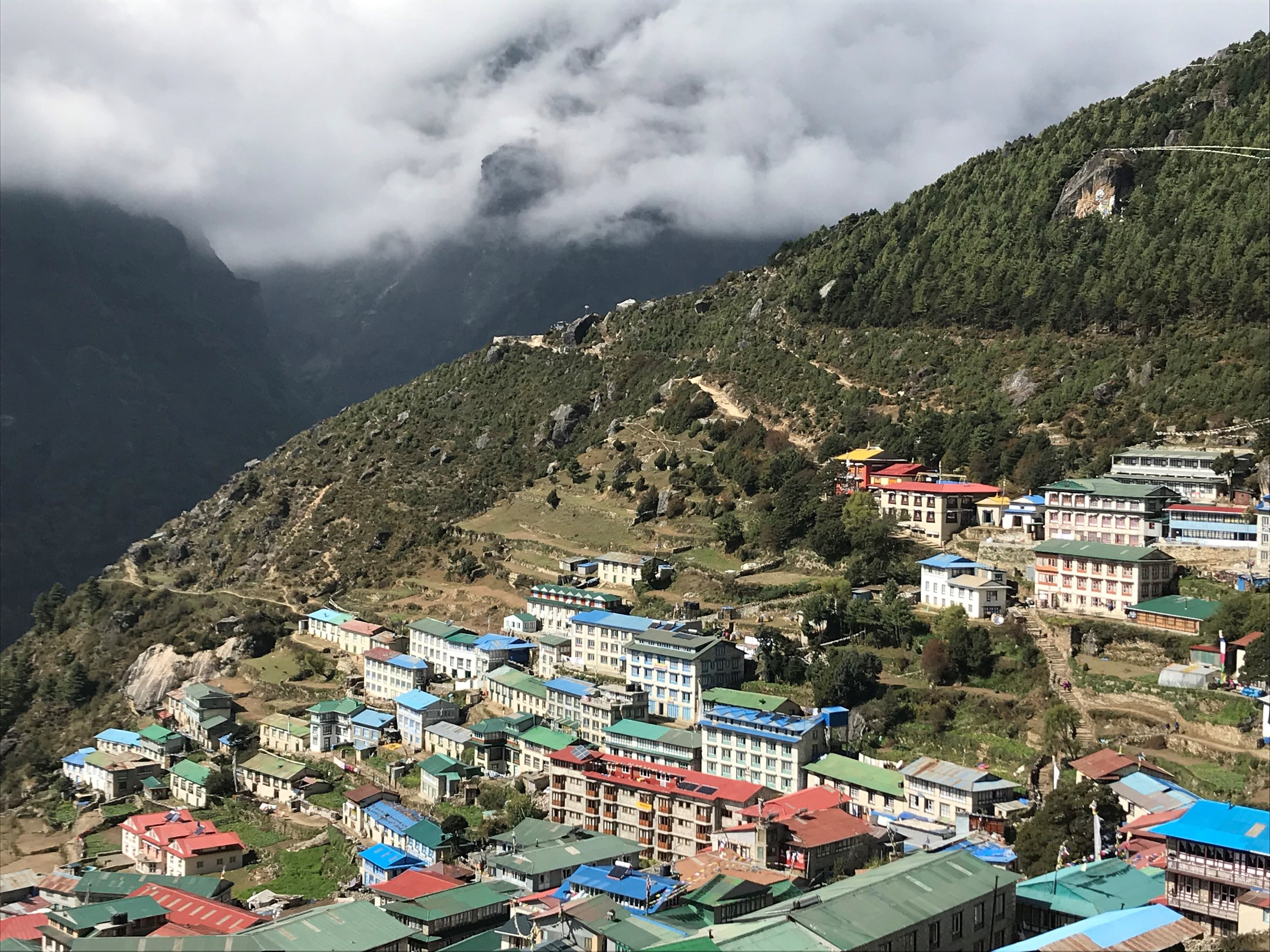
Village of Namche Bazaar

After the gentle start, the next few days were hard. We hiked up the small peak of Gokyo Ri (Ri=mountain) from the village of Gokyo (4750m). For many Westerners this is the culmination of their trip. The views of Mt. Everest can be spectacular, and many hike up Gokyo Ri (5357m) to photograph the bigger peaks.

Cho Oyu at sunrise, from Gokyo
Ascent of Gokyo Ri
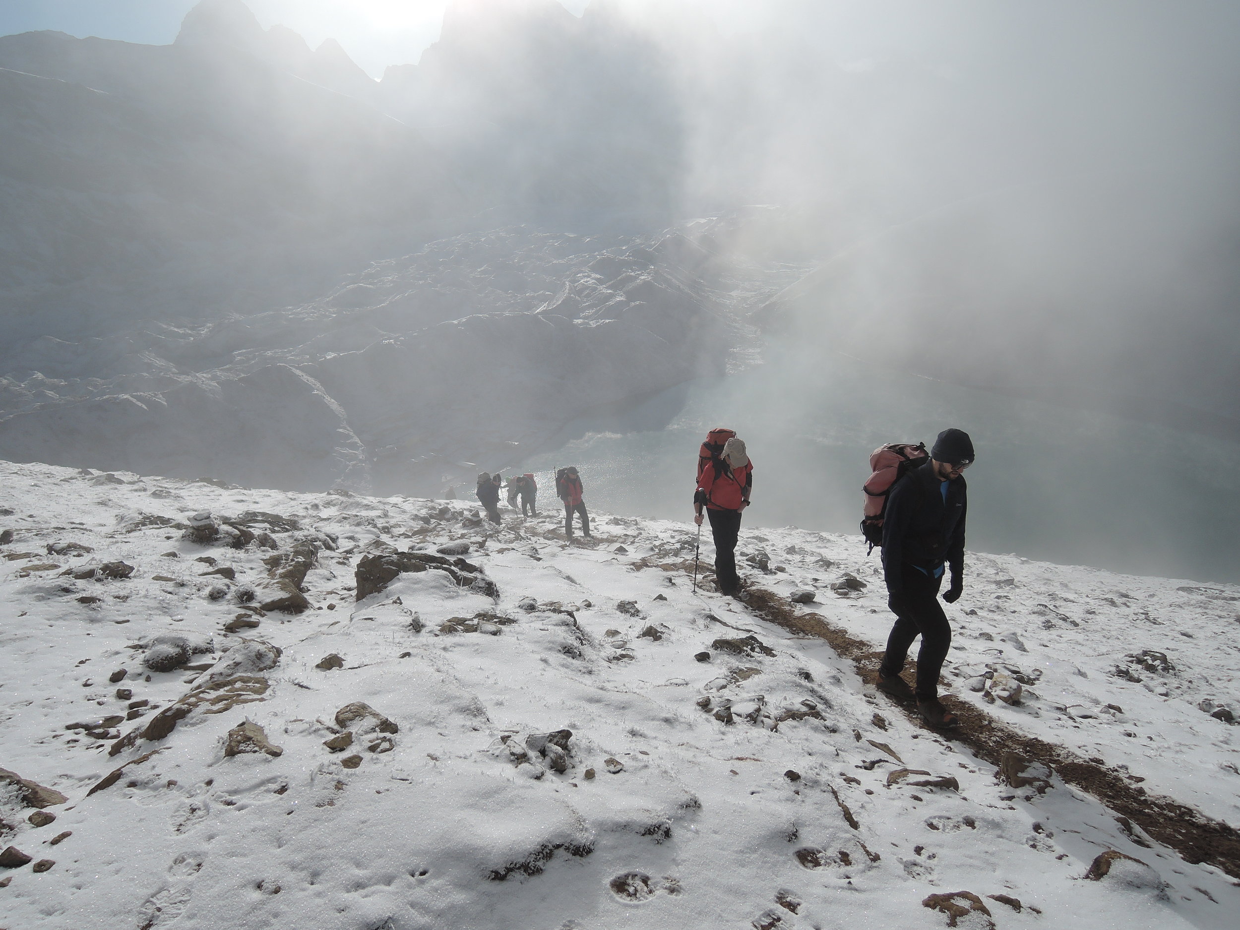
That was the first time the pace was such that a couple of people could not continue. Later that same day, we climbed the first pass (5420m), Cho La (La=pass). It was late October and we encountered the first snow of the season. It was a bit sketchy since a number of us were wearing “trainers” as the Brits say (day hikers/approach shoes). Our climbing gear had been ferried forward for the more technical ascents ahead of us. A hand-line was fixed for the descent on the far side of the pass.
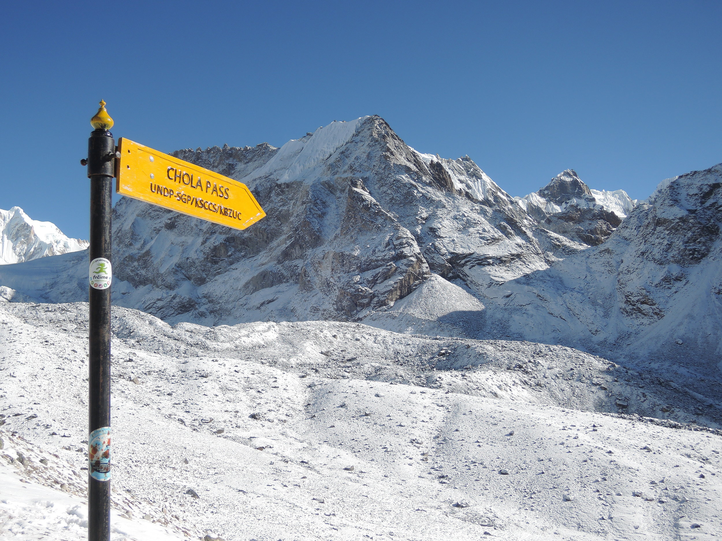
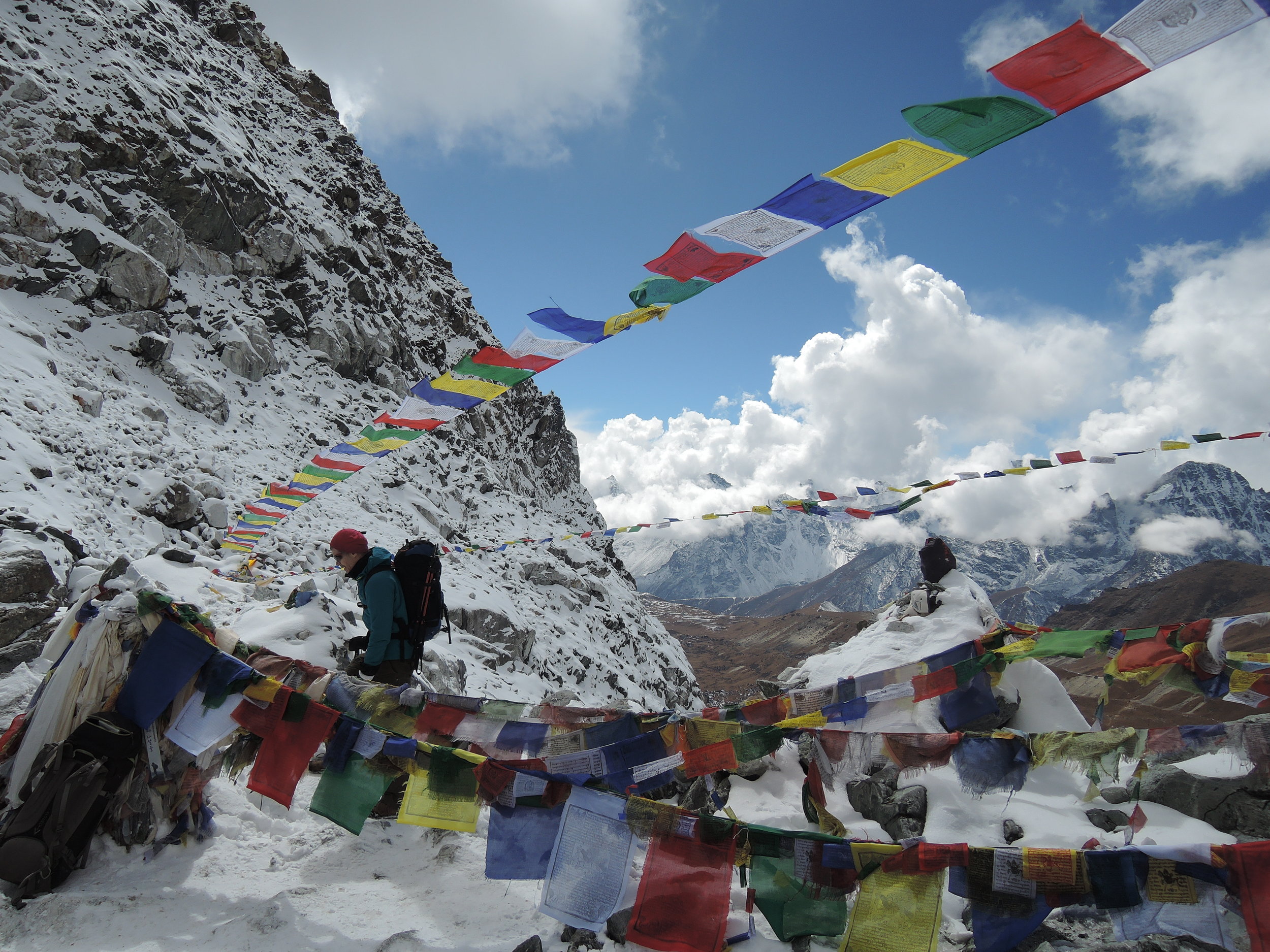
Cho La Pass with Prayer Flags
Most of the nights were spent in “tea houses.” The group dining areas were heated with dung-fired stoves. The heat, hot tea, and nourishment were all welcoming. But the semi-private rooms were cold and stark…feeling a bit like a prison when you were tired or sick. If your neighbor was really sick, you could hear it clearly…all night…through the very thin walls. After the pass, a few people decided to take a lower route down into the valley due to poor acclimatization and illness. The cacophony of coughs was growing, and it would only get worse. The scenery was stunning. Nothing but soaring peaks and glaciers, with the occasional, photogenic yak.

The next day most of the group climbed a second pass - Kongma La (5528m). It was supposed to be a bit easier but I found it to be interminable. It just wouldn’t end. I couldn’t tell for sure, but it looked like the guides were as surprised as we were by the endless ascent. Near the top of the pass we were met by two of our Sherpas, one with a huge pot of steaming tea, and the other with a bag of snacks. Those were the first smiles we had seen all day…maybe for a couple of days. This night was our first in tents. We camped at base camp for Pokalde (5806m), which we originally hoped to climb the next day. After three days of hard uphill, most of us were in no position to climb anything. We were too tired and took a semi-rest day. Three of us did a partial ascent (5600m?) of Pokalde, and the rest did short walks from camp.

Ascent of Pokalde (base camp next to the lake)
It was clear by now who was performing well and who was not. It wasn’t a matter of who was “fit” or not, as overall fitness has surprisingly little to do with acclimatization. It’s a combination of staying healthy (avoiding travelers’ diarrhea or a lung infection), acclimatization at the cellular level, and being in good hiking/climbing shape. Some of the fittest and more experienced individuals were not functioning well at all. Luckily, I was staying relatively healthy. On my previous trip to Nepal, I was literally the last guy in line on the uphills. I coughed so much my abdominal muscles would spasm in the middle of the night and I could not sleep for the last few days. I almost took the helicopter ride out when offered. This time I was a bit paranoid about staying healthy …and slathered myself with hand cleaner at every turn. I tried to avoid sitting close to the big coughers, and made sure they didn’t hand me anything. The bathrooms were rather scary. Avoid touching anything not a part of you when using the bathrooms.

We hiked down to the village of Chhukung (4730m), and met the group members who had dropped down into the valley earlier. The next day we headed up to Island Peak base camp (5100m). A few people knew they were not healthy or acclimatized enough to go any higher, and they split off and headed down valley. The hike to base camp was cold, flat and dusty. Base camp itself was stark, except for the colorful tents from all over the world. It felt like we hadn’t seen trees or anything alive for some time.

A few more people turned back before we headed to high camp (5500m) the next day. It was an emotional time for those who finally had to accept that they could go no higher. They had spent considerable time, money and effort; and this was as far as they could go. We were now down to 9 people from the original 18. Nine was still almost too many for high camp, as the tent sites were small and few.

Ama Dablam in alpenglow
We woke around 3am. The group size was still too large to stay on schedule and before we left high camp, we were passed by people who had started from base camp. The route began with several hundred feet of low angle scrambling up gullies and shattered rock. By daylight, we traversed a rocky ridge and found ourselves at the snow line. The whole party (11 including two Climbing Sherpas) tied into one rope, which was a total pain in the ass.

We weaved among seracs and crevasses for a short time, using a snow bridge here and there. Soon we were up on the top of the glacier, and the track came to a wide crevasse that seemed bottomless. There we encountered 4 ladders all lashed together, spanning the crevasse. It looked like something from a bad movie, but this one was real. Everyone immediately questioned internally whether this scary-looking crossing was a smart move.


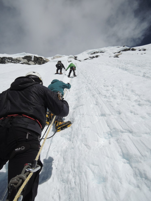
It was mid morning. It wasn’t clear if we could meet our turnaround time, and regardless we would have to re-cross this ladder-from-hell on the way back down. Then we would be even more tired, and it might be dark. Two people (the rational ones?) turned back there. I kept going…still not sure why. I figured if I didn’t have a REALLY good reason to turn around, I should keep going. Another short uphill section on the glacier brought us to a wide expanse of glacier under a 300m headwall. Here there was a long section of fixed ropes to the summit of Island Peak (6189m).

Two more of our party were “knackered” and went no further, and these were perhaps the two best climbers left in the group. I almost joined them, but I turned to look away from the summit and had a Snickers bar. I tried not to make a decision, or verbalize that I thought I was also done. The snack and brief rest brought me back to life and I continued on. We were now down to five (plus 2 guides).

I've done little/no jumaring. I figured there are multiple opportunities to rest, and the rappel line was just 10-20ft over from the ascent line. So if I couldn’t drag myself up the route then I could get over to the rappel line and turn back. The slope started at 45 degrees and steepened to 60-70 degrees. There is nothing delicate about jumaring. You get your feet under you, unweight the rope and shove the jumar up the rope, slump back down and hang in your harness…then do it over and over and over.
I think I fell asleep a few times, just for a couple of seconds, while resting (hanging) on the jumar. We crossed a rock band, which seemed vertical. I don’t know how long it took, but it was several hundred feet long. Suddenly the slope ended on a ridge. A short scramble put us on top and we summited at 1130am.

Island Peak summit ridge
We descended rapidly, and got back to high camp 11-12 hours after departing. Somehow we made it across the ladders over the big crevasse. We quickly packed our gear at high camp, and descended into the valley. We had to find our way back down to the village of Chhukung in the growing darkness. I was with one other member of the party and we were ahead of the rest of the group. Soon it was pitch dark and snowing slightly. I was not at all sure where I was going, but my partner did. Every now and then we were passed silently and quickly by our porters who were bringing gear down from high camp. They darted by like ghosts. It was amazing how quickly they could move through that terrain with no headlamps. It seemed to take forever to get within sight of the village lights. We met our trekking guide Raz, outside Chhukung 3 hours after leaving high camp. He was worried about our late arrival, well behind the porters. I have never seen a man so happy to see me. We were fine, just very tired and very slow. The remainder of the party was well over an hour behind us. Raz and a few members of the group waited in the darkness and falling snow to see them back to camp.

Island Peak
As we headed back downhill over the next few days the coughs grew louder and the pace slowed. The "Khumbu cough" infected all but one or two in the group. We limped into Lukla for the flight back to Kathmandu. In the end I was lucky to stay healthy enough get to the summit. I ended up with a bad cold, but it stayed out of my lungs. On the way back I didn’t poop for 4 days…but that worked itself out (ferchrissake drink more water).

Island Peak is not technically hard. But it’s far enough from civilization that you are (a) likely to be acclimatized but (b) unlikely to be healthy by the time you get there. The fittest and the most experienced in our group did not get to the top. If you are lucky and stubborn, you just might summit. It was my first time over 20,000ft. The scenery is amazing, the people are kind and friendly. If you love the mountains, you have to go.
